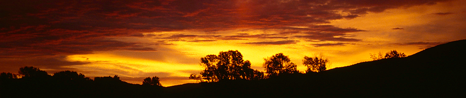
Microsoft has just released the latest version of Flight Simulator – after an absence from the market for about a decade. And although there is a lot of frustration and a general feeling “the product has been released too early” and some bugs indeed impact the experience quite negatively (e.g. the infamous CTD – also known as “Crash to Desktop”) – the general question remains: how good is the flight feeling really?
My example is a tour I made with a friend in 1996 – it took us from Denver in Colorado all the way to San Francisco in California (and beyond). The tour is described in detail in other blog posts but this one puts the focus on comparing the scenery I have captured in my photos with the scenery rendered by Flight Simulator 2020.
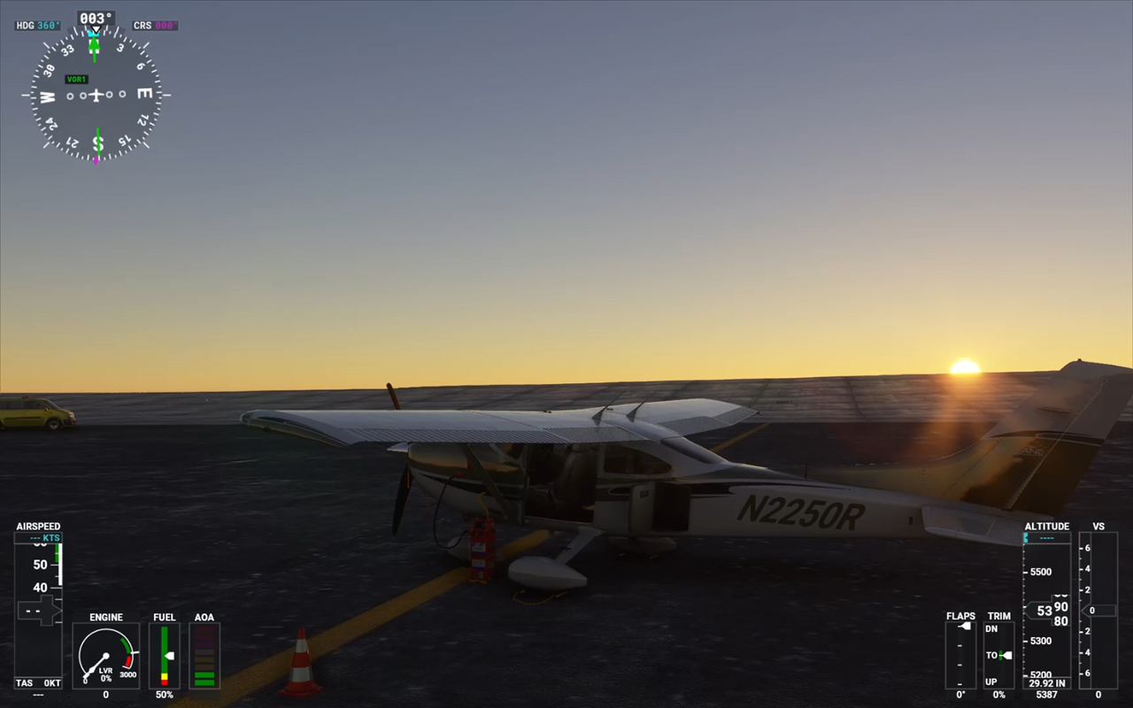
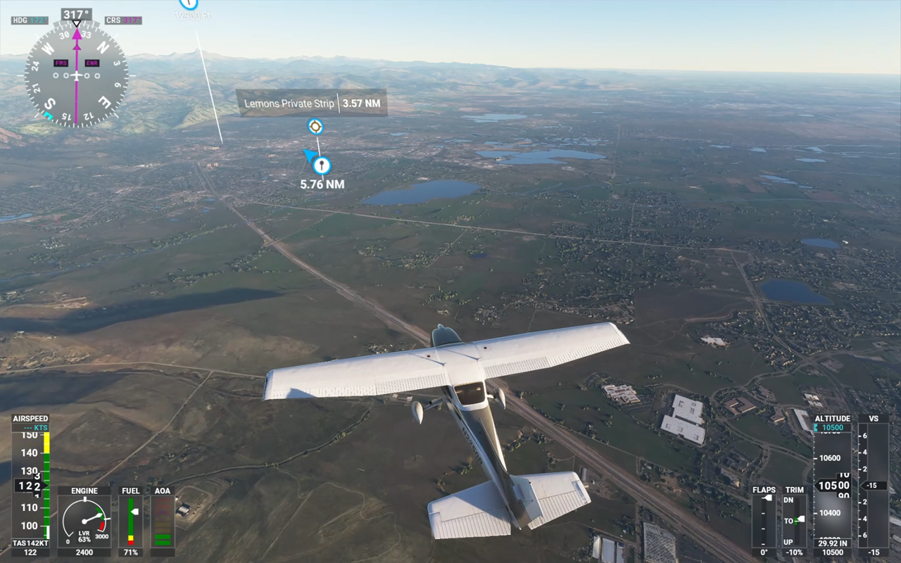
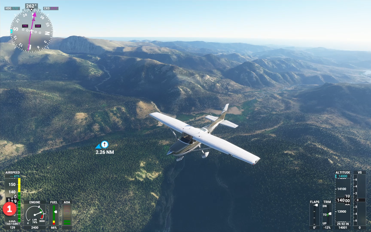
Two Add-Ons are installed – KDEN Denver International Airport and Carendado’s Cessna CT182T Turbo Prop. Flight Planning is done with Little Navmap. The screenshots deliberately have the cockpit instruments visible so the details of the current flight situation are documented.
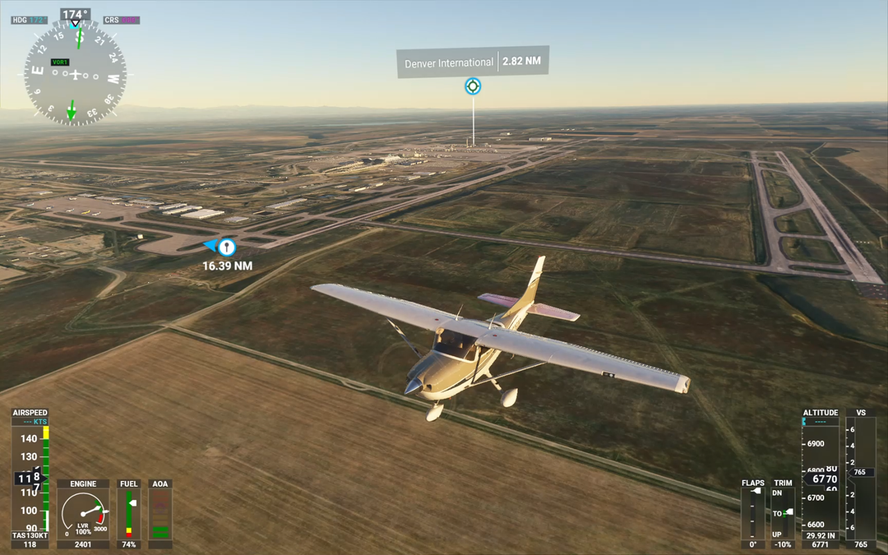
Heading out of KDEN, leaving on Runway 17 and then turning west, the flat lands east of Denver and the gigantic barrier the Rocky Mountains are presenting is more than obvious and very well rendered in FS2020.
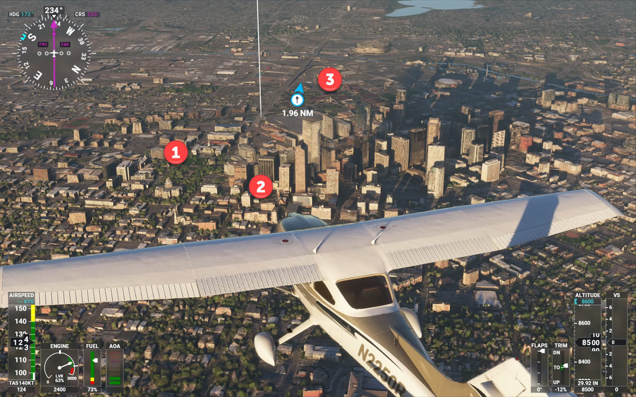
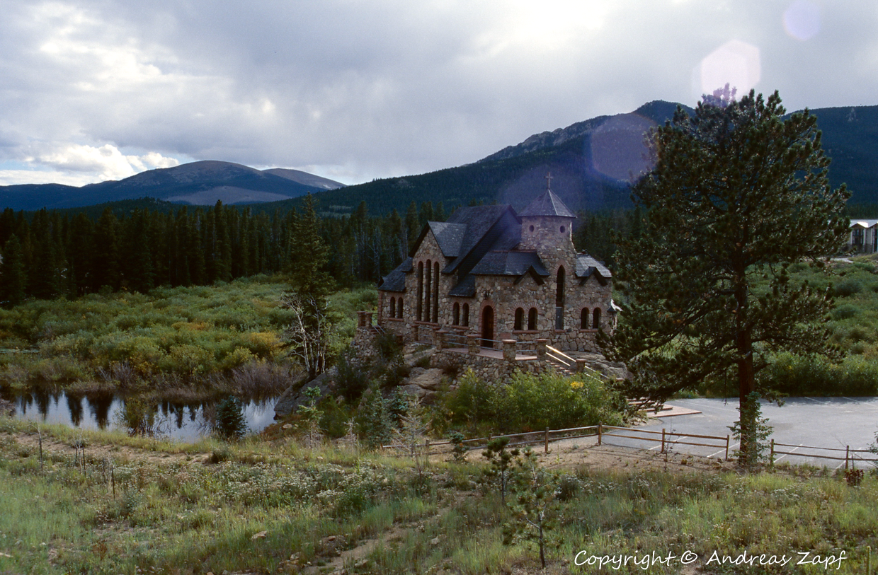
Here are a few images taken in Denver in 1996. the first one is a photo taken from the stairs of the State Capitol and showing the Civic Center and the Civic Center Park. The second one shows the Civic Center Plaza building and the third one is an image of the St. Elisabeth of Hungary Church.
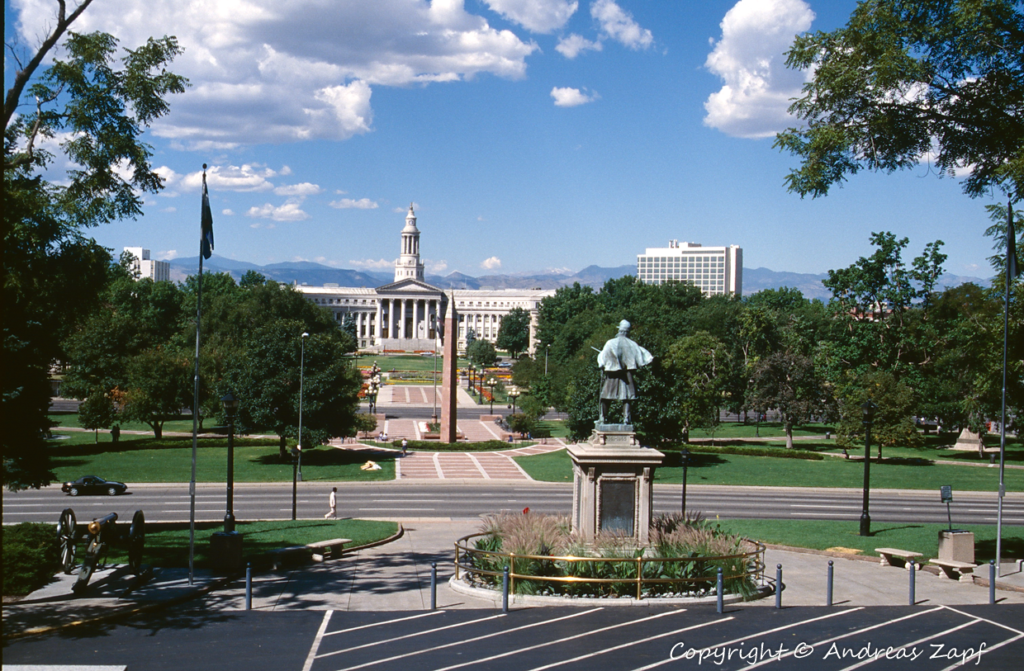
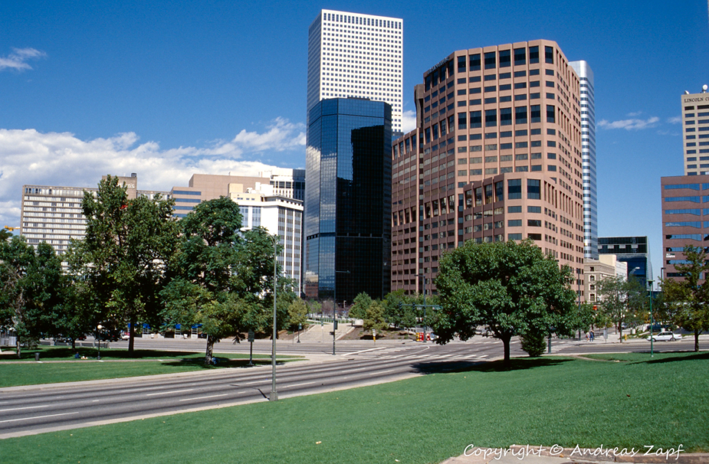
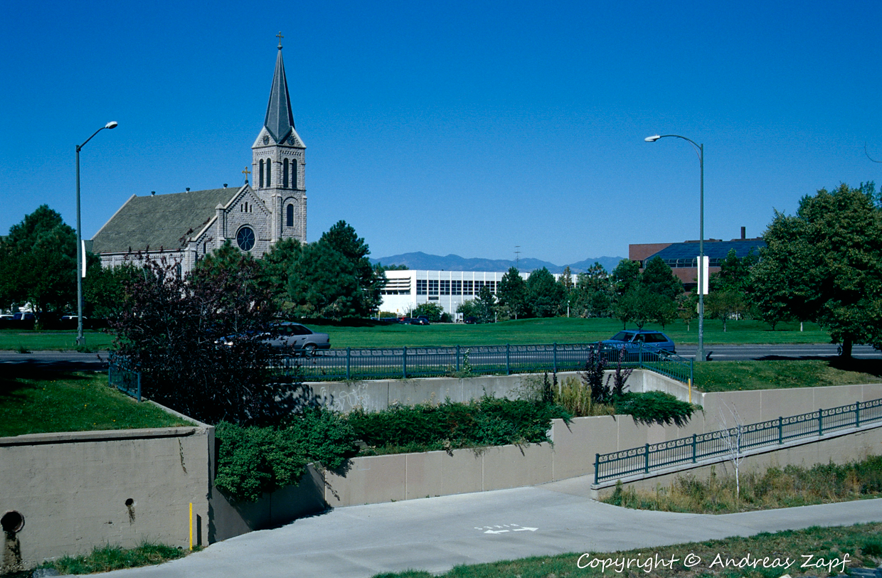
Denver – out of the box Flight Simulator 2020 – does not show the buildings in such a great detail but they are recognizable: State Capitol and Civic Center (1), the Civic Center Plaza (2) and St. Elisabeth (3).
And there are some more downtown buildings that we visited way back when – and their counterparts in FS 2020.
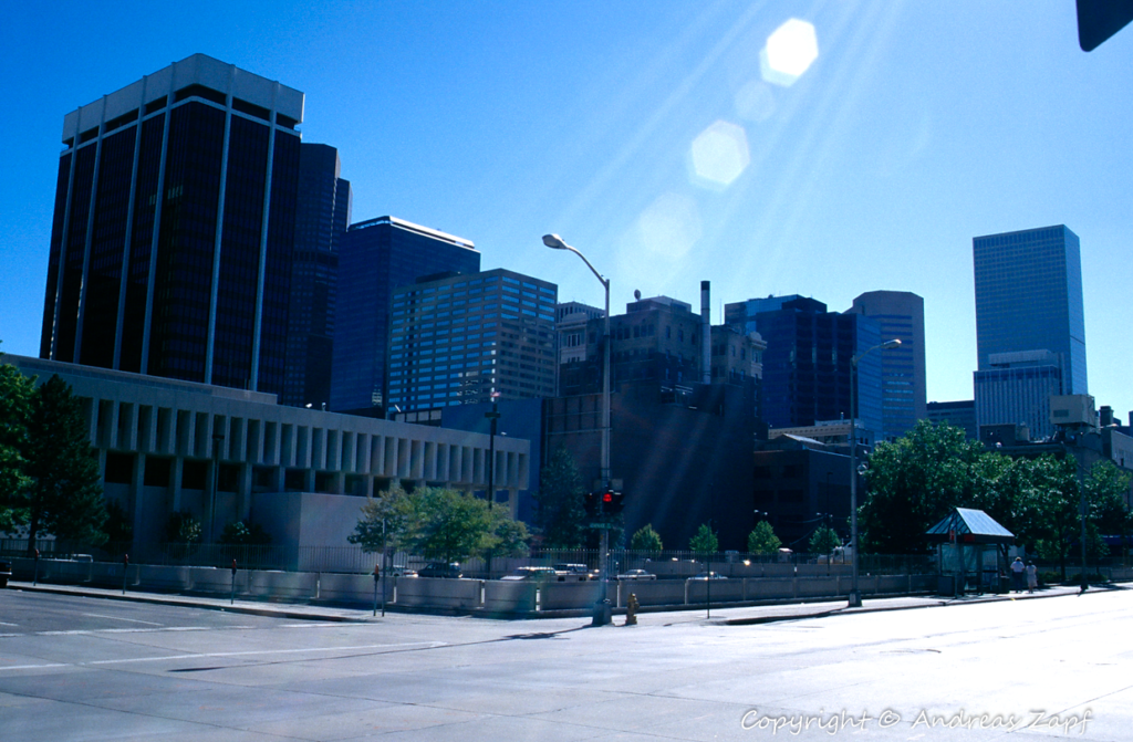
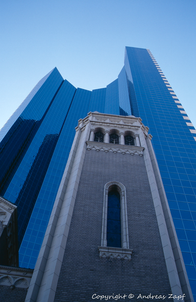
These are from the images above: 18th Street / California, the Independence Plaza with the 950 Curtis Street Tower next to it, the Daniels & Fisher Tower, and the Holy Ghost Church with the 1999 Broadway Building behind.

From Downtown Denver, the route takes us right up to the foot of the mountains, Boulder is our gateway into the Rockies.
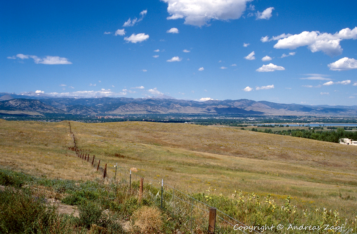
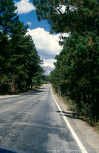
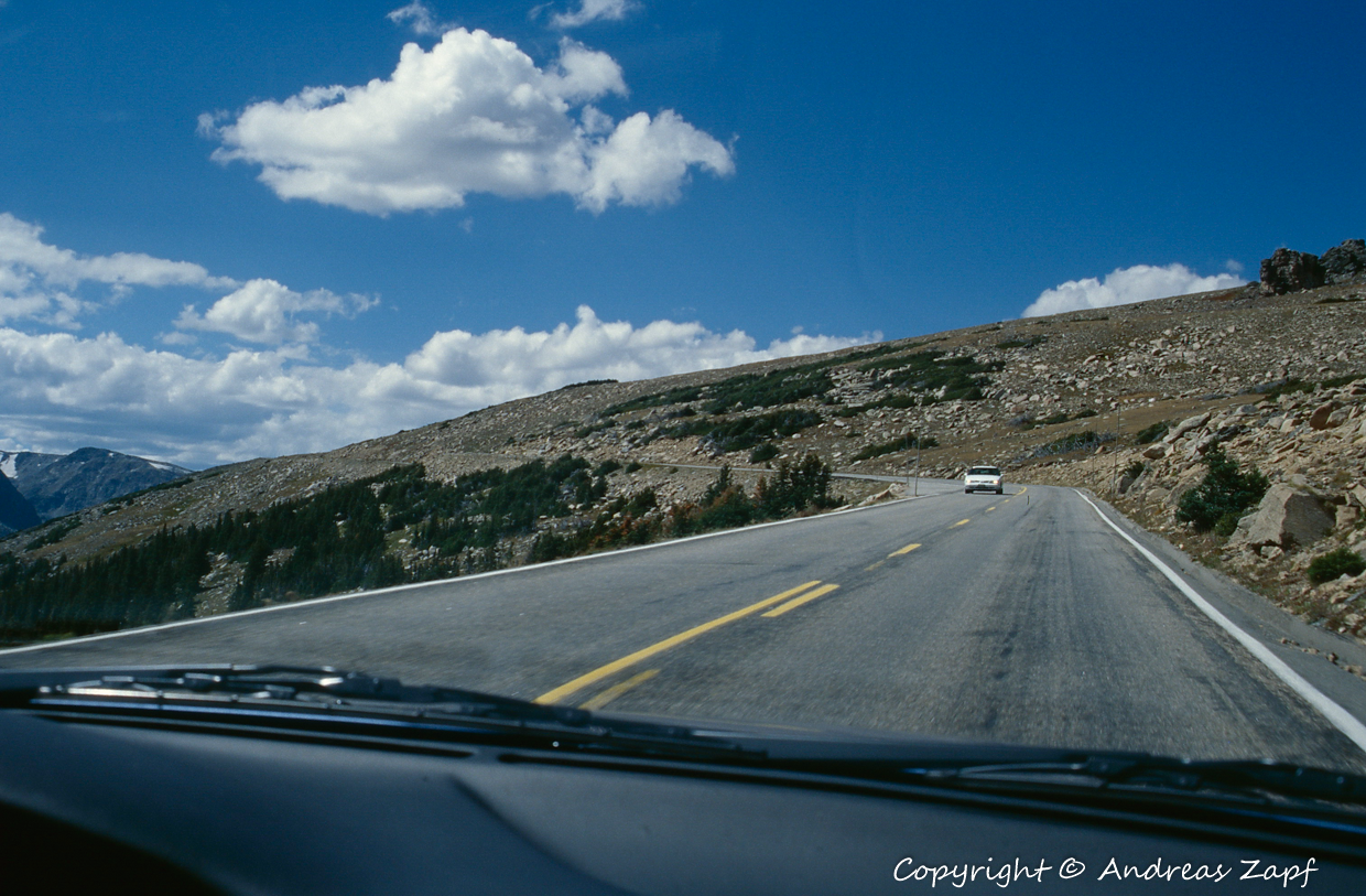
Following Highway 36 from Denver to Boulder, we are pulling over to the curb in 1996 – and we are enjoying the same view from the Cessna in FS 2020.
From Boulder, things start getting “mountainous” – the Highway 119 is cutting into the Rockies, following the valley the Boulder Creek has cut into the stone throughout the ages.
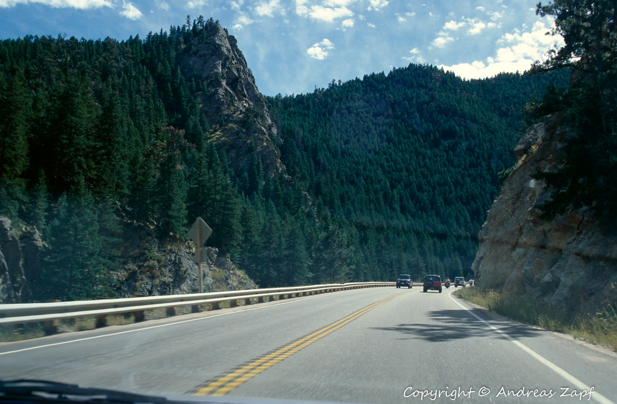
The first images shows a stretch of the Highway 119 around the Boulder Falls area – the valley and Boulder Falls are recognizable from above as well.
Further up Highway 72, the St. Catherine’s Chapel on the Rock is not picked up very well – but maybe, that is a bit too much to ask.
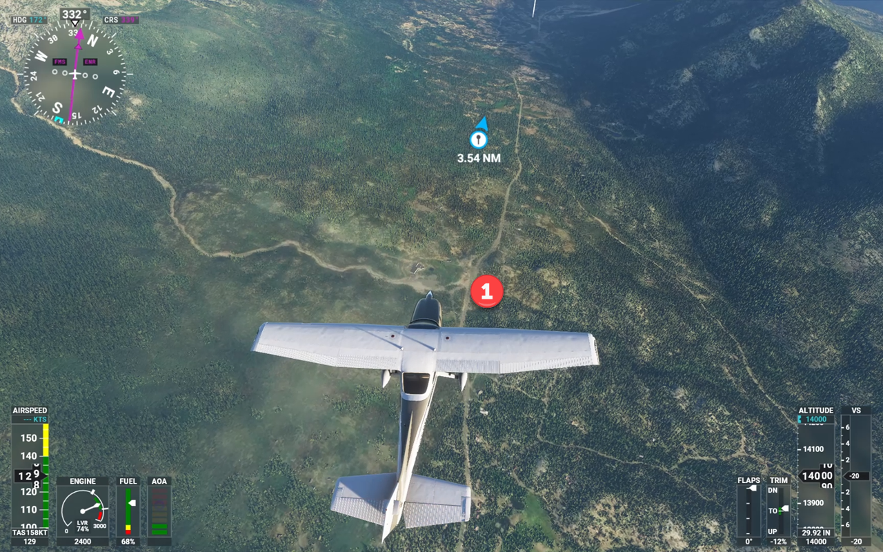
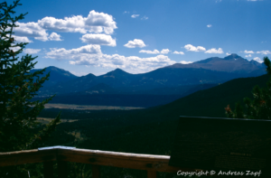
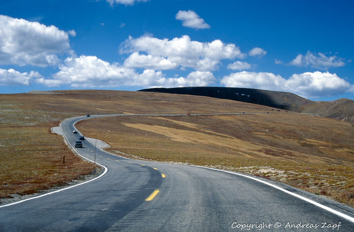
A little bit up the road Highway 72 runs past Lilly Lake, a very scenic little lake and our first entry into Rocky Mountain National Park. And although the early morning flight finds the little lake in the shadows, it is there and the view into the distance also is reflected pretty well.
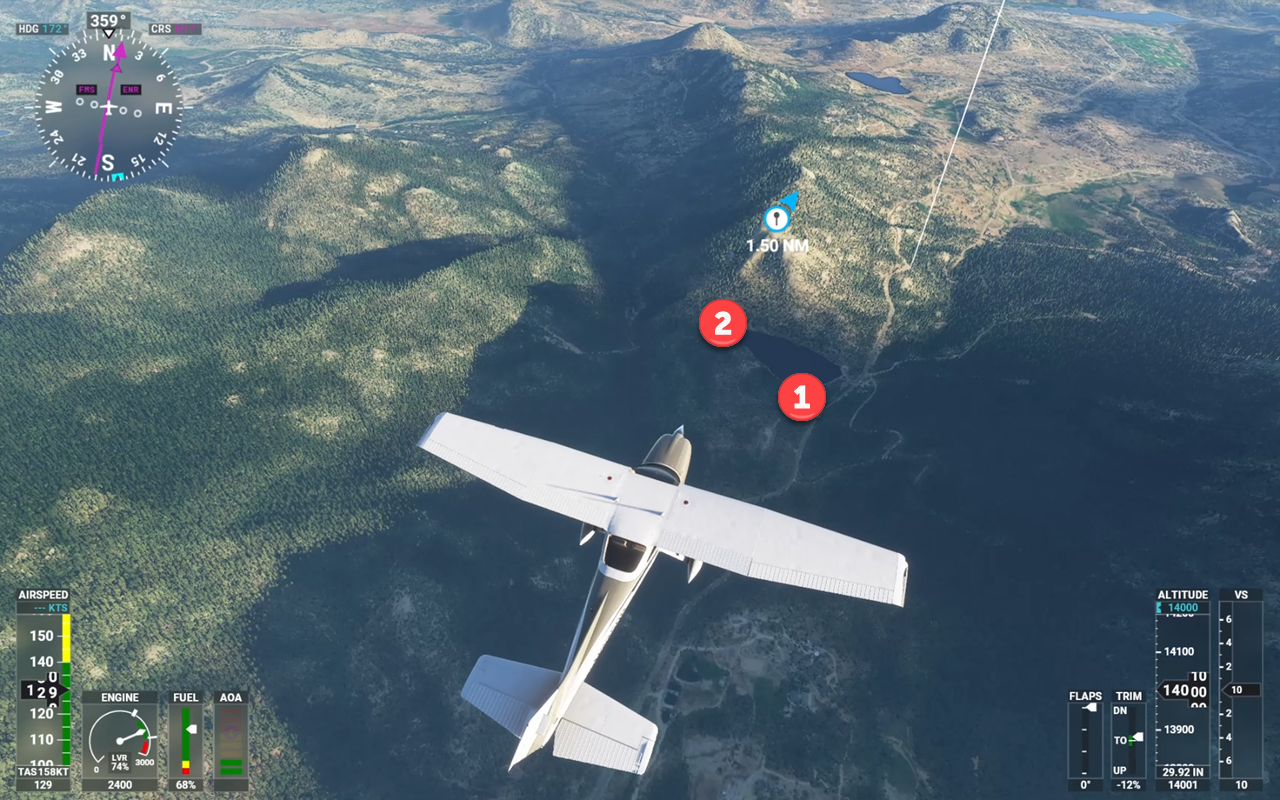
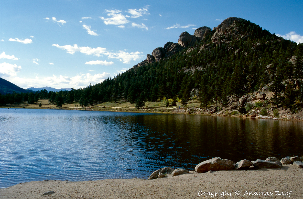
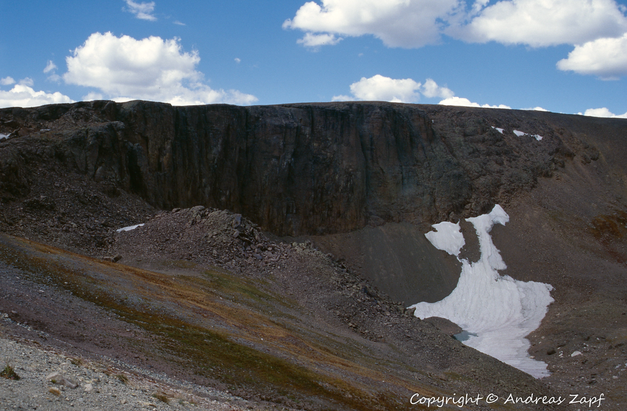
Following a night in Estes Park, the first target of the new morning was Bear Lake in the Rocky Mountain National Park.
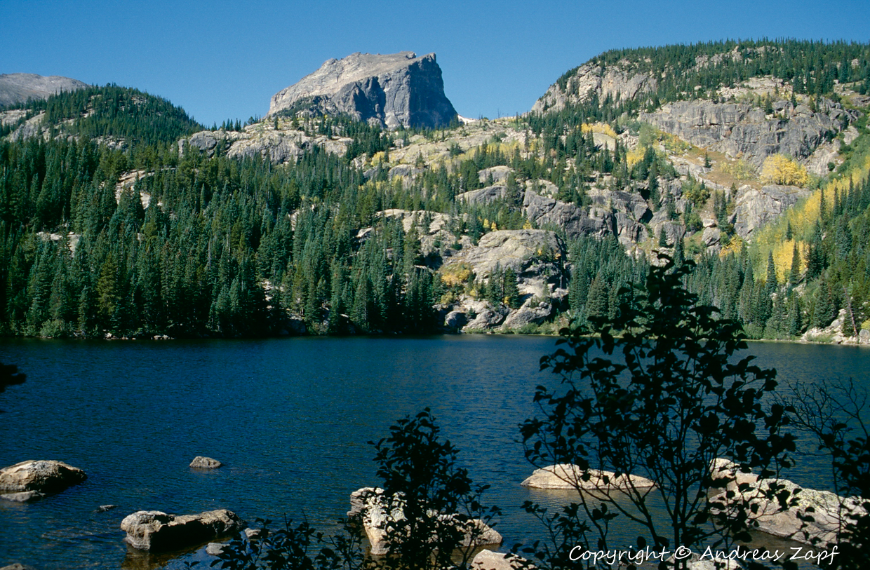
The rendering of the steep cliffs above the lake is a little bit mellowed by the Flight Simulator’s terrain mesh but all in all, the trerrain itself is very convincing.
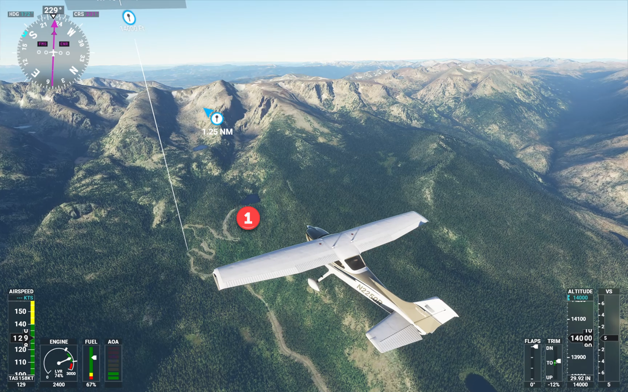
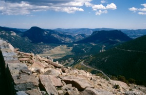
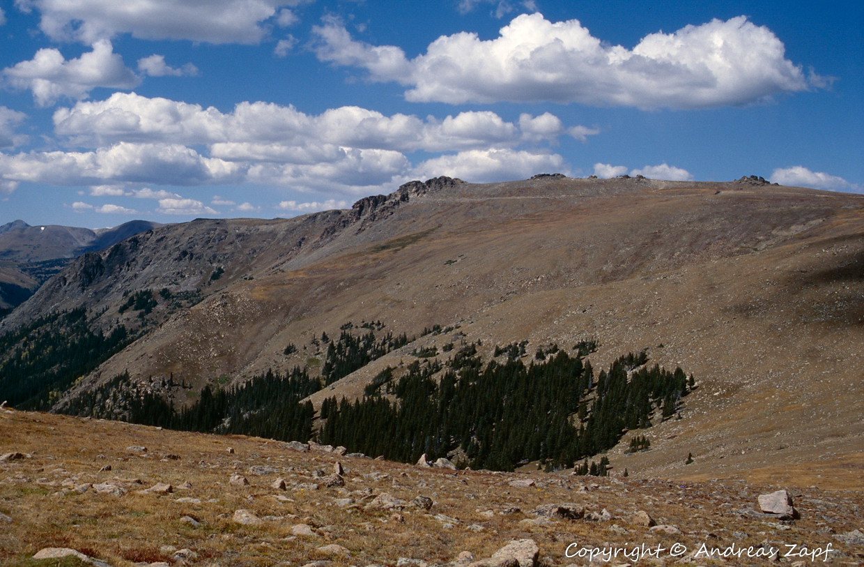
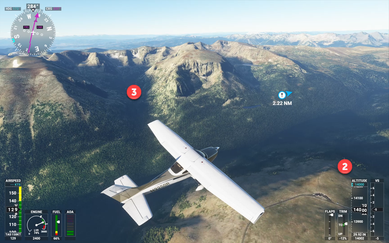
From Bear Lake, it is back to the Beaver Meadows Entrance Station and then up to Deer Ridge Junction to intercept the Trail Ridge Road. Trail Ridge Road is a 31 km / 19 mi high alpine road that has its highest point at 12.183 ft. / 3713 m just behind Lava Cliffs. At that hight, it runs at the top of the mountain ridge, above the tree line.
If you need a map of the park, you can download one here – which might be easier to follow the individual spots the images were taken.
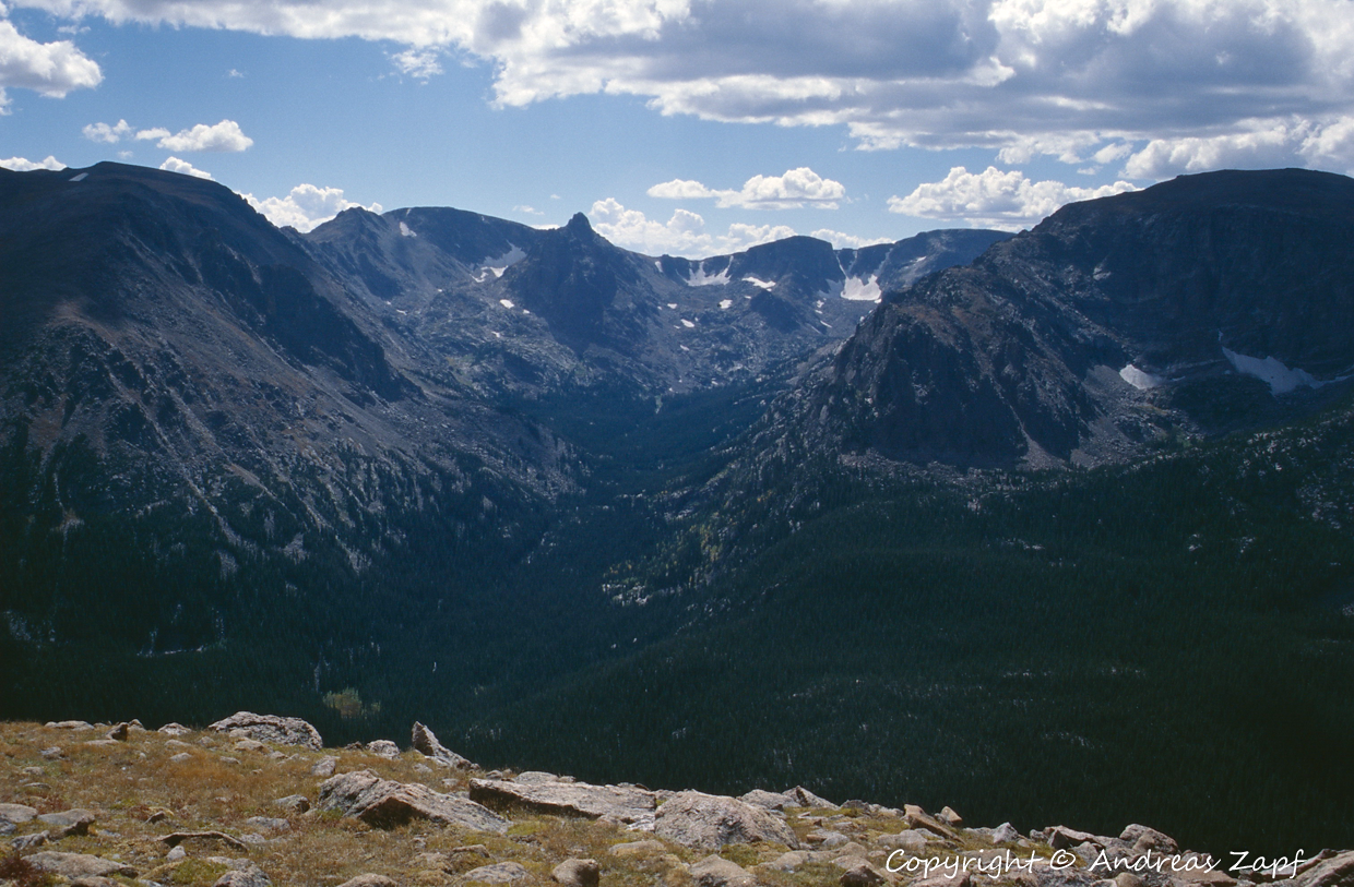
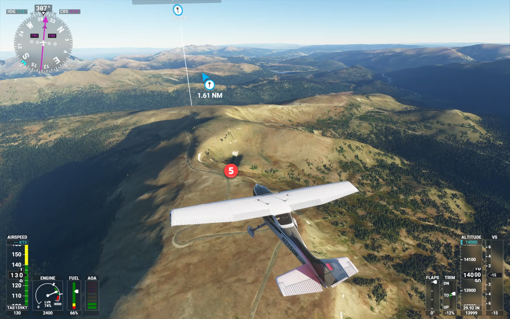
The first image was taken around Deer Ridge Junction while the road is still running through the large forest areas. The second one is taken from Many Parks Curve and the thrid one is captured at Rainbow Curve.
And because Rainbow Curve is a bit far out (and we need to look back to re-enact the photo), here it is a few seconds later:
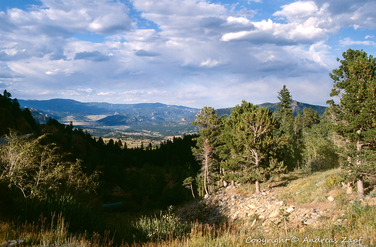
From there on, Trail Ridge Road runs above the tree line – and even in early September 1996, we had traces of snow left and temperatures around 0°C.
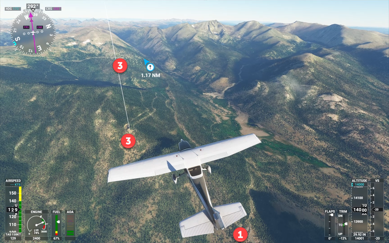
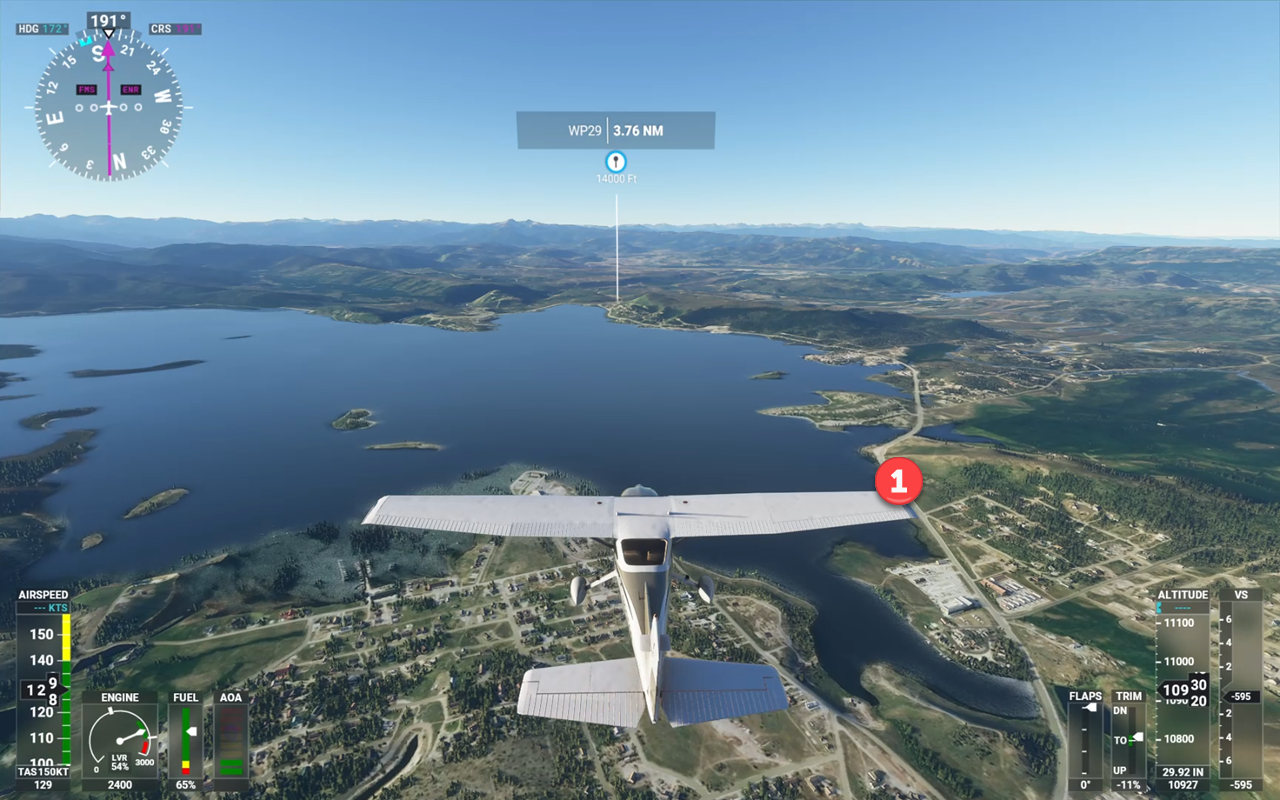
The Flight Simulator’s recreation of the country is stunningly accurate as you can see in the next gallery section. The locations of the above images are marked with their respective numbers in the FS 2020 photos.


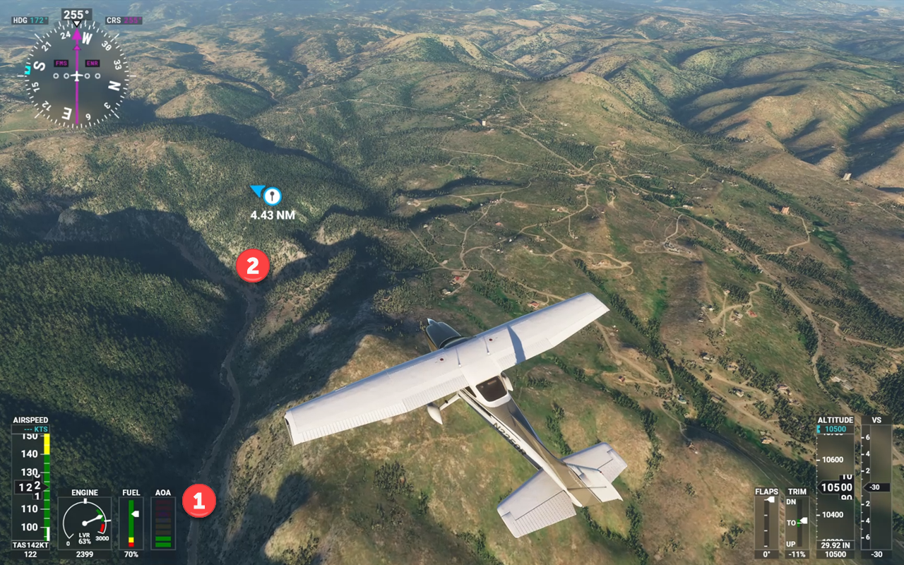
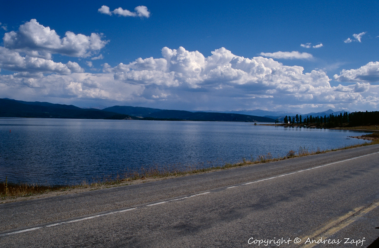
From 12.000 ft., it is now all downhill to Shadow Mountain Lake, Lake Granby and the town of Granby, the local airport – KGNB – at 4.975 ft. We have crossed the first mountain range of the Rockies. From here, it is “go west”, with places such as Hot Sulphur Springs, Kremmling, Steamboat Springs, and Craig, our final destination for today. All following Highweay 40.


Again, those images can be directly related to the screenshots from FS2020 – numbered accordingly.
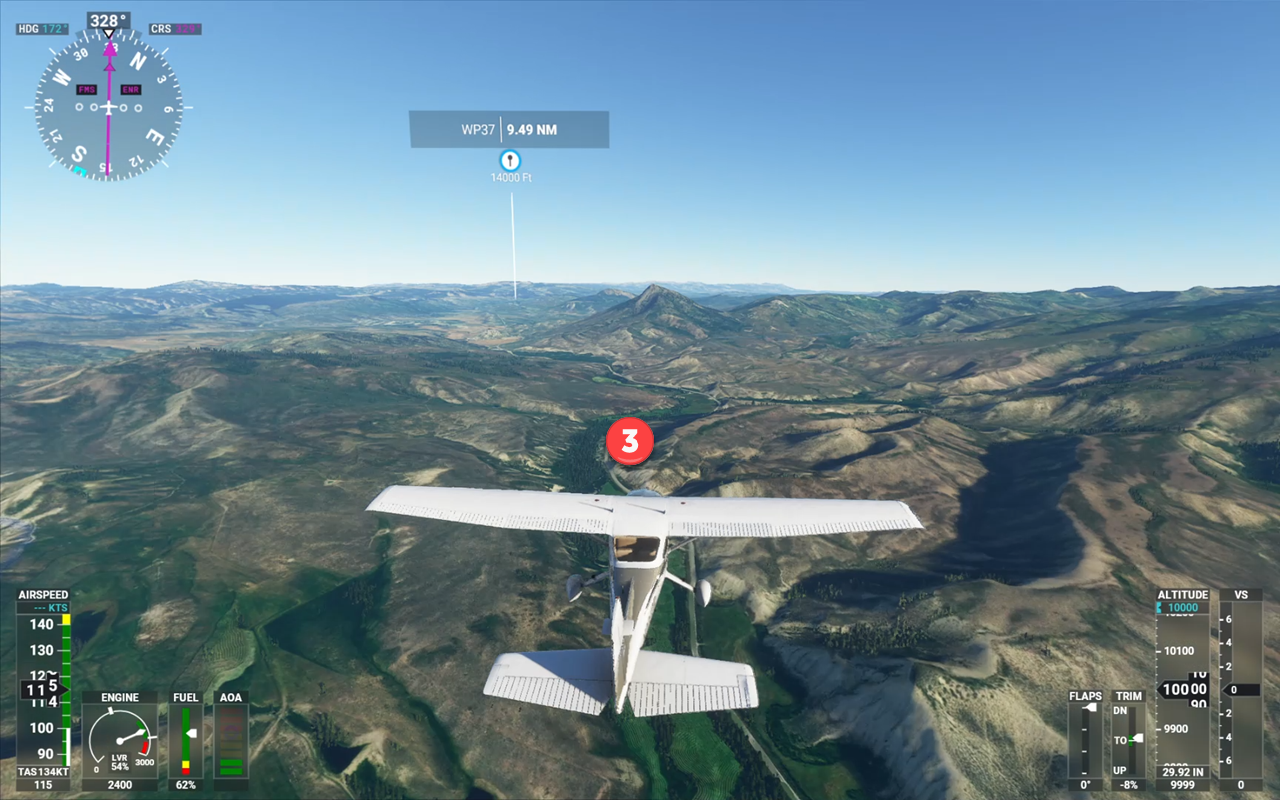
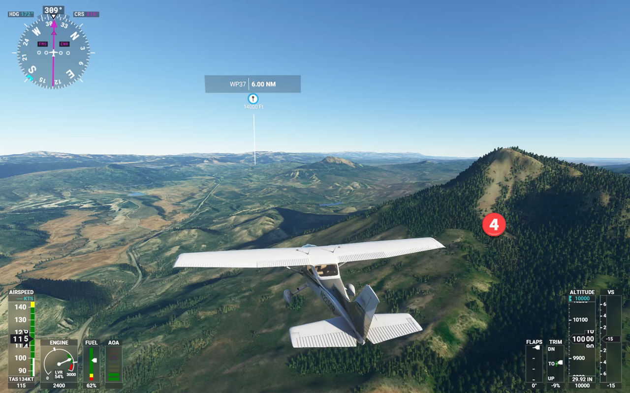
We got Lake Granby (1), Wolford Mountain Reservoir (2), Whiteley Peak from a distance (3) and close-up (4). By the way: only this flight allowed me to geo-tag the last image – I originally was under the impression that it was taken in a different location… but a Street View check in Google Maps confirmed what Flight Simulator 2020 had suggested…
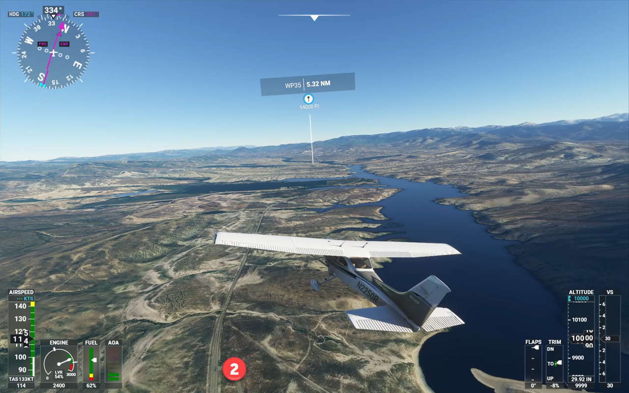
I ran out of light on our trip – but the rest of the flight in FS2020 shall no go undocumented. There was some extreme low-level flying which provides a good change to get an impression of the impressive graphical handling of trees, meadows, water, etc.

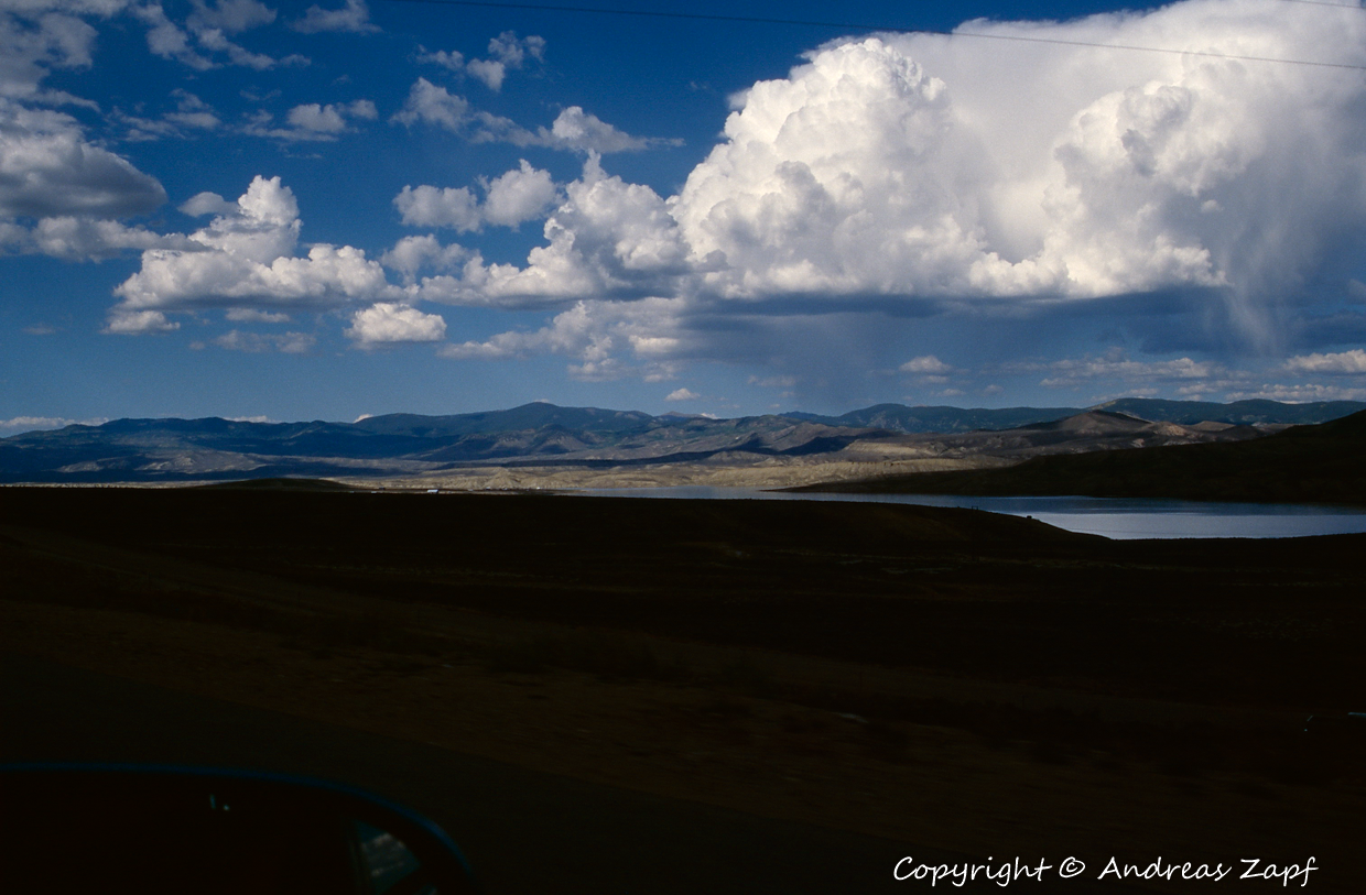
While in the mountains, the scenery was dominated by the steep mountain ranges and the green of the forests – just a little bit past Steamboat Springs, the countryside changes, both in my photos and in Flight Simulator 2020.
Back in 1996, we spend our night in Craig, in what is today the Bear Valley Inn of Crag (1) – I am not sure it wasn’t a Best Western Motel back then but anyway, the building is still there and the photos confirm the aerial view from above.
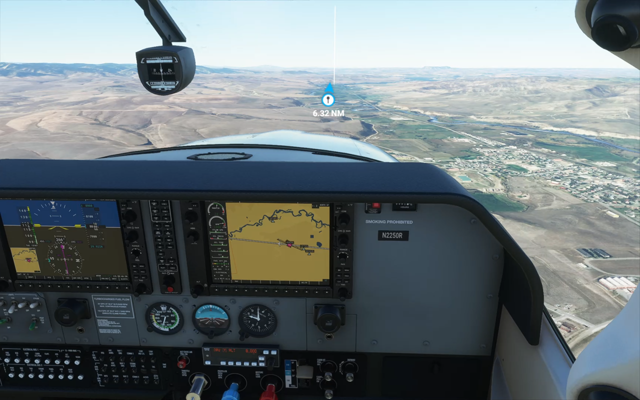
I am finally taking the Cessna into Craig Moffat Airfield (KCAG) after a flight that had taken some 90 minutes in the air (but two days on the road). Worth to mention: there was not a single glitch in the simulator after I had to deal with the “loss of avionics bug” right at takeoff. And given that my old computer is not the fastest one, the flight had a remarkable performance in terms of frames and fluent display.

Conclusion: Flight Simulator 2020 has its quirks and bugs. But once you know what to expect, you can get around them until they (hopefully) are fixed in one of the next releases. The quality of the terrain rendering and the mapped satellite images provide for a real-time VFR flying experience – if you want to add in IFR for navigating a predefined flight plan, that is also possible and works quite well.
You need to be prepared for the occasional bug, even a “Crash to Desktop”. But it is far from happening “on every flight” and “every few minutes”. When it happens, it is upsetting, of course. But the joy of VFR and light IFR Flights still outweighs the problems. However, you need to have the right expectations: the Flight Simulator (even in the past) was never published to provide the ultimate experience when it comes to realistic aircraft handling – that was always left to the add-on developers. Same with the landscape, the scenery: the overall scenery is good (in terms of FS2020 even great) but additional scenery packages by the community or add-on developers will make the difference. In other words: if you buy, make sure you are having your expectations set straight – or the system will do it for you…