Call me a kid – LEGO for Men in 2012…

You might want to call me a kid – but then, what’s wrong in being a big kid if it brings some fun and does not hurt anyone? This post is actually inspired by a friend and her three-year old daughter visiting: the kid needs something to play and one of the things I easily grabbed at the local supermarket was a box of LEGO. No particular theme – just a box of bricks but it reminded me of the days when I loved to play of LEGO for hours and hours – stuff that is not available on the market today (unless you have some luck on eBay)… so I started digging a bit.

Finding the old stuff

The first thing that I was interested in is if the “old stuff” can still be found somewhere in electronic format – mainly the images of the boxes as well as the instructions to build the items.

To no surprise, there seem to be a few more “luna”tics our there  (like myself) and the one set I had a great amount of boxes from was what is now referred to as “Classic Space” theme.

The above shows the original logo of what is now “classic space” stylized in a mosaic of LEGO flowers.

In my search for the original LEGO Sets, one of the best sites I came across is a LEGO Wiki – here, you can browse the different LEGO styles and boxes including the set number. I remember, for example, having owned the Beta-1 Command Base, the Alpha-1 Rocket Base and two of the major spaceships – the Galaxy Explorer and the Starfleet Voyager.

So the first part of my question has been answered: there is more than enough information out there on the original (classic) LEGO Themes including instructions (mainly on peeron.com, here the link to the Classic Space Theme) and in may cases an inventory list (which will be quite useful a bit later).

Building it…

Of course, everyone who ever has played with LEGO wants to just “build” the set. So if you are after the rare old ones, you got two choices: you see if eBay has a physical model on sale or you fall back on virtual reality and model the set on the computer.

The LEGO Company itself is providing the LEGO Digital Designer – for free! Although the idea of this program is to allow people to plan, model and then order their very own sets, it is also possible to use it to just to through any instructions and create the model “virtually”. If have done so with the Glider of Beta-1 Command Base to show you an example.

As we will see later, you may have to cut some compromises in the process but once you got used to the LEGO Digital Designer (or LDD as they call it), you can build almost any model out there… almost.

So for now, this is it – it can be done. Next time, I will walk you through actually doing it!

Posted in LEGO | Tagged | Leave a comment

26 Years ago – Writing a Computer Program in 1985

Way back last year I wrote about having aquired a Sinclar ZX 81 home computer on eBay. Back then, I had problems hooking the old veteran up to my modern TV – and I still have. I have – again on eBay – gotten myself an old 5.5″ Black & White TV and hey, I am having a stable but grizzled image of my ZX 81 screen on that box. Too tiny to work with, too bad an image to even imagine how I could ever have spent hours and hours and hours in from it a very similar setup… but good enough to know it works and is in good shape… now, it is time to leap back in time and share a little bit about programming the old classical one with you.

…but using today’s Computer to do it

There is no way on earth that brings me back in front of the ZX 81 with it’s bad image, its notoriously lousy connectors (which usually provided for at least one “involuntary reset” every 30 minutes) and a cassette recorder to save the programs to. But if you want to experience those old days, there are actually a couple of ZX 81 emulators out on the Internet.

The one I am using is simply called 81 (or “EightyOne” if you put it in words) . You can download a copy here.

Secondly, I got my hands on an old CHIP Computer Magazine, published around 1985 or so.

Back then, computer magazines had been a popular source for new programs: because they focused around providing you with Listings of all types to feed your home computer.

I don’t think that anyone today can imagine to buy a magazine, spend hours to type the listings (BASIC or Assembler for the ZX 81) into the computer and then be happy with it. No, today, we are expecting to get all software for free from the Internet – downloading packages that exceed the available RAM on the ZX81 a million times – and much more.

The tiny program I am going to use as an example has been named Rocket-Pilot by it’s author – and I hope, this very author sees it as a tribute to him and all the other ones that wrote software in these days.

What you are seeing on the right side is the actual BASIC listing as published in the CHIP Special Magazine shown above.

You had no other choice but typing the code in – and once you had finished doing that, hoping it would save to what we referred to as the Datasette – an artificial word trying to describe that we had been using simple music cassette players to record our software.

The problem with the ZX 81 was that it did not really have a “keyboard” – at least none that we would recognize as one today. The ZX 81’s keyboard was a plain plastic sheet with contacts beneath the “keys” – so there have been no real physical keys on that system (makes it very hard to “type”).

Making things even harder was the fact the BASIC commands could not simply be “typed” – each command was associated with a specific key and indicated on the keyboard above the key: for example, if you wanted the command PRINT, you had to press the P key (but only once because the computer would have interpreted this single keystroke as a command input.

The commands had actually been referred to as Keywords by the ZX 81’s manual – and the computer showed by the display of its cursor that it now expected a Keyword – it simply displayed a white K on black ground.

This was – by the way – also the entire display when the computer was switched on – switched is actually the wrong word because there had not been a switch: you simply plugged in the power supply to make it go…

The other obstacle to overcome for a modern style programmer is the lack of any type of procedural or even object-oriented programming language! BASIC back then was flat – your program consisted of a set of line of codes which had been enumerated (usually in steps of 10) and your only means of making the computer execute different areas of the code had been GOTO and GOSUB commands. If you try writing that type of code today, being used to objects, properties, methods, delegates, etc. – you may end up wondering how the programmers of that time had been able to provide some of the great software packages of their time like Wordstar, dBase, etc.

Here is my first line of code:

To get there, I had to press 1 to get the line number (1), then E to get the Keyword REM, then a number of spaces to move the text into the next line, then Shift-I for the opening bracket, C for the C and Shift-O for the closing bracket. The rest of the text is simple typing (you notice the cursor is not an inverted L (instead of the previous K)  – the manual does not say anything about the meaning of the L – maybe it means Literal or something like this. Eventually, I should close that line with a New Line to move it up into my listing. I will “quickly” do the next line, then show you what the screen looks like.

To illustrate the simplicity of the human-machine interaction, let’s look at the next line of code:

30 IF INKEY$="" THEN GOTO 30

This has taken me about 5 seconds to write in the blog – on the ZX 81 it goes like this:

  • Type 30 for the line number.
  • Press U for the keyword IF.
  • Switch to the Function level (SHIFT – Cursor changes to inverted F), then press B for the function INKEY$.
  • SHIFT-L, SHIFT-P, SHIFT-P for =””.
  • SHIFT-3 for the keyword THEN which makes the machine recognize the next things needs to be a Keyword (Cursor switches to K).
  • Press G for GOTO, then finish of with 30 and New Line.

Nice, hm? How much easier is the straight forward simple type-it-in approach of these days? We love the Auto-Complete function of Visual Studio 2010 but hey, the auto-complete had been there a quarter of a century ago – and it sucked!

The first lines of code are now in the computer’s memory. A couple of things come to mind:

  • It is absolutely tedious to cope with the approach of auto-complete of these days – typing the code takes soooo much longer…
  • If you want to format the output of the PRINT commands, you need to manually count the characters and insert spaces to enforce line breaks.
  • There are no lower-case letters – everything is always upper-case!
  • Waiting for the user to press any key (and then evaluate it later) is a nice combination of checking INKEY$ to contain any value and GOTO the same line – see like 90.
  • Lines that are committed are not freely editable like to day – there is no mouse to click somewhere into the code nor are there any cursor key to move around. If you want to edit a line, you need to enter the Keyword EDIT and the line number!

Now, that I have spent a good time writing the code, it would have been a great idea to save it – to tape! Just because the ZX 81 was knows for its involuntary resets because of the very simple power plug – no power, no code…

The Emulator makes the life a little bit easier – not much though. You need to go to the Tape Manager, then either select an existing “tape” or create a new one.

Then, on the ZX 81, you need the keyword SAVE – either SAVE “” or SAVE “<Program.bas>” will work. It is then that the recording to the cassette would start (and your program would hopefully save). Speaking of saving (and loading): here is a video of the load procedure for the few lines if code we have written so far: ZX81 loading code.

Code Maintenance

Today, we are telling the programmers to write clean code. Rules apply – like using speaking names for variables. No magic numbers! No more GOTO & GOSUB… wonder where that came from?

I have typed that but I would have to study it to understand what it does… however, it shows the classical dilemma of a programmer of these days: memory was sacred! And every byte we see on the screen costs one byte in the computers main memory. And the ZX81 originally only came with 1024 Bytes (1KB!) of RAM.

There simply was no room for speaking variable names, no room for in-line comments, basically: there was no room for nothing!

 Cashing in…

Eventually, it is time to cash in – the whole program is about 1700 Bytes (which means it only would run if you had bought the 16KB RAM Extension for the ZX 81). It is a very simple game – see for yourself. And click the Screenshot to play the video!

Posted in ZX-81 | Tagged , | Leave a comment

The “Grand Tour” – Western United States in 1996 – Part II

The night in Estes Park was not much to remember – some motel along a stretch of road with many more motels, one looking like the other. After some quick phone calls “home” to let people know we are safe and sound we headed for the Rocky Mountain National Park Entrance.

“First thing we had to learn is that you might need some time to get into a park – and you should think about buying a Golden Eagle Passport for unlimited admission in all US National Parks if you plan to see more than three or four. Today, the Golden Eagle is about 50 US$, admission for one National Park is about 10 US$ – so figure it out…”

As I just found out, the Golden Eagle Passport program has been discontinued and replaced – I am sure, there are similar offers these days (although I am not so sure about the 10 US Dollar…).

September 10th, 1996 – Rocky Mountain NP and Colorado

The Rocky Mountain National Park is actually divided into two parts – the lower part around Bear Lake and the Trail Ridge Road which crosses the continental divide and takes you from the warm sunny temperatures up above the treeline into a much colder climate.

Down at Bear Lake, however, we have been greeted by a warm and sunny day, temperatures around 30°C and clear skies. The first little walk was taking us around the lake, offering a great view of the lake and surrounding mountain ranges which stand up to 4.000m, guarding the lake.

Once in the park, you will figure out that it is separated in two major parts – the “low-lands” around Bear Lake and the “high-lands” with Trail Ridge Road as highlight. Both are really neat but two totally different climates – so make sure you are properly dressed…

“Some say, Bear Lake is the most beautiful place in the park – I would not say so but for sure it is a wonderful place to be. Bear Lake is not that big but its location in a small valley with lots of green trees on the hillsides that are mirroring in the water give the place a special touch. It is a bit touristy and crowded but if you like, you can break off and walk some of the less frequented trails. In any case – you will like it.”

From Bear Lake, it is just a short walk to Alberta Falls so we decided to take that one as well. Although the walk is not a long one, it is quite nice and we had been lucky: not too many people on the trail with us. We passed Alberta Falls and walked on for a little while until we found ourselves a nice spot where you could just sit by the creek and enjoy nature developing around us.

Again, planning a trip like this one would be much easier these days: in 1996, our source of information was travel guides available for the Western United States and some large-scale maps given by the German Automobile Association (ADAC). Today, you can visit the park’s web site and download the map of the park together with a ton of additional information on trails, things to see, weather conditions, etc. – but still, we did get around in 1996 and we worked it out with the available information just fine. And maybe the fact of not knowing it all ahead is much closer to exploring it than planning it ahead and them simply ticking it off on a list.

“Once you are finished with the warm and friendly “low-lands” – get into the car and start on Trail Ridge Road. While Bear Lake is below 9.000ft, Trail Ridge Road goes up to more than 12.000ft – even in late summer a chilly place to be. The street raises through several spectacular curves each one giving a new and overwhelming view of the great Rocky Mountains. At the end – above the tree line – there is nothing but pure tundra vegetation.”

Done with the “low-lands”, we took to the car to new heights (literally) with Trail Ridge Road climbing from the valley up to a bit above 3.700m where even in late summer temperatures drop to around 0°C and patches of snow are present all year long.

Getting up there and then getting down on the other side is just one of the most spectacular scenic routes I have been on. As you can imagine, that road is not open year round – snow and ice usually mean a closure with the first snow coming in and into late spring or early summer.

“Slowly, Trail Ridge road descends to a normal level (at least what is normal in Colorado) and if you get a chance, don’t miss the Colorado River that starts not far from here – you won’t get that close so easy again.”

With the descent of the road down into Granby the rest of the day was devoted to driving. Our day had started in Estes Park – but it was supposed to end in Craig, CO, which was still a bit of a drive away. And although names like Kremmling and Steamboat Springs sound vaguely familiar, I do not have a lot of memories about that part of the tour. Maybe the fact that we had a small area of rain clouding the afternoon, maybe the fact that Rocky Mountain National Park had just left too many impressions… I do remember arriving in Craig later the day and was happy for our Best Western Motel to be where we had expected it to be…

“Once we left the Park, there is a good way to go until we are in Craig where we planned to spend the night. Well, it’s mostly driving – all traffic bound for the skiing resorts around Steamboat Springs is on this road and it’s probably not that much fun to drive – on the other side, it is the only good road to Craig.

Why Craig? Well, it is the best way to get to Dinosaur National Monument and with all this Jurassic Park stories in mind you might not want to miss that one. Besides, it is a route not many tourist take and I think it is a good chance to see a bit more of America than you would when just driving the highways.”

Speaking of the Best Western in Craig: today, there is a Best Western in Craig listed on the www.bestwestern.com web site. But I am relatively sure it is not the one we stayed in in 1996. Anyhow, pictures I still have from that evening and Google StreetView suggest, that we had been staying in the Bear Valley Inn.

September 11th, 1996 – Dinosaur National Monument

“Don’t go Utah!” is what we have been told as a good bye from the hotel staff that morning. And “Be aware of Elk on the road!” – which turned out to be a wise advice. The tour for the day was one of the longest we had in one day during the tour. From Craig in Colorado we planned to go west, see the Dinosaur National Monument and then turn north to cross the border into Wyoming and come up to West Yellowstone in Montana – so roughly 600 miles to go.

“Well, the Dinosaur National Monument is really in the middle of nowhere. Located around 100 Miles west of Craig with nothing but a road and silence in between: if you like, get out of the car, walk a couple of meters and listen to the sounds of nature – it might well be that you will not hear anything but the wind.”

But first things first, we needed to fill up some gas – Highway 40, which is taking you from Craig to the Dinosaur NM, is one of the loneliest stretches of road I have seen in the US. So it is wise to have the tank full, water supplies ready and enough energy to make the long drive. The landscape though is fascinating – a long stretch of barren land, desert-like and bare of any trees or large rivers as far as I can tell. Places like Elk Springs and Massadona don’t ring a bell.

“The National Monument itself consists of a huge area of protected landscape and a visitor center built around the exciting wall of dinosaur bones. There are thousands of them – and even in this mess of bones you can still identify single individuals.

In the early times of the world, it happened to be the bed of a river – Dinosaurs died and sank to the bottom where their corpses where covered with sand. It took mother nature millions of years but while preserving the bones inside, the former bed of the river was raised by forced deep in our planet – today it stands at a 70° angle.”

We quickly found our way into the Quarry Visitor Center, looking with amazement at the huge collections of bones in the sandstone wall.

Having seen the visitor center we paid the Green River a short tribute, then continued our way westward to Vernal where we intercepted Highway 191 northbound towards Wyoming.

“Heading north takes us into Wyoming. And here – far away from any touristy place – we go through one of the most boring bust fascinating landscapes: just after we crossed the border to Wyoming, the 191 raises and a wide valley opens to our right hand. We are about 1.000ft above the valley, it looks like there is nothing down there but a dirt road – and the whole valley might be 30-40 Kilometers wide. I found a couple of places in the US that where more deserted than this one but at least from out point of view it looked like a nice place to stay – no desert.”

Following Highway 191 northbound for about 200 Miles, crossing into Wyoming and driving towards Jackson took the better part of the day. There is not much to remember besides the wide open country and the Rocky Mountains lining up on the horizon.

One thing I know: Wyoming was nowhere close to what I expected it to be – although I did not know what I have expected. But seeing the wide open prairie stretching from horizon to horizon under blue skies again brought it back: that feeling of the vastness of the West.

“Going farther north, we crossed I80 which took us a couple of miles back east to Rock Springs – looks like a small town that is just there to host a McDonald’s that serves the truckers that come along.

From Rock Springs, it is a good 170 Miles up to Jackson – the southern starting point into Grand Teaton NP and Yellowstone NP. 170 miles of land so wide open you can see the Rockies to the east from more than 100 Kilometers. It looks like not many tourists drive up here and I have no clue what Ernst thought about this part of the trip – I enjoyed it.”

At the end of the day, we had to learn our lesson about carelessly not booking hotels ahead: Jackson was booked, so was West Yellowstone and the way to Cody (east of the Yellowstone Park) was blocked. The result: we had to sleep in the car after having wasted a lot of time driving around trying to find a motel… so when we finally put to sleep, it was quite late and quite uncomfortable.

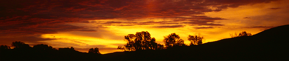
“Of course there was no bed to catch for the night – Jackson was booked, so was everything else in the area…what do you do? Hm, find a nice spot to eat (which we failed to) and a nice place to sleep (which worked out) – get some beer to make sure you don’t care too much about the inconvenience of the car, the Bears and try to sleep. Well, at least you get a nice sunrise because you won’t sleep for too long :)”

Nonetheless, we had seen a lot for one day and covered a good amount of road on our way to the North-West.


Posted in 1996 US Tour | Tagged | Leave a comment

The “Grand Tour” – Western United States in 1996

Why would one write about a trip that has happened about 15 years ago? Well – maybe because of that, maybe because there had been an “initial” trip report on my previous web site and maybe because I am thinking of doing another one some time soon.

Also, because this is a story about the opportunities today’s hardware, media and Internet services offer when it comes to re-tracing steps from long ago.

Back in 1996, I took nothing but an old-fashioned camera with me and several rolls of color slide films. All in all, there must have been about one thousand pictures from the four week trip, about 750 which I kept. They had been buried under dozens and dozens of other slide magazines down in my basement for the better part of the last 15 years.

Then – about two years ago – I decided it is time to take my color slides into the digital age – and bought an Reflecta DigitDia 5000 Slide Scanner. It took me another two years to view the results, make the required corrections to the scanned images and get to write this post.

And I am not done yet – the remaining task is to add the missing Geo-Tags to the images which made me re-trace my steps from way-back-when and finally sparked the idea to write down the story here…

To give myself a little more fun (and credit to my original report), I will re-cite the original words and will amend and comment as I see fit now, 10 years after the initial report was written.

September 8th, 1996 – Leaving for the United States

“We started the tour in Frankfurt/Germany – the airport is just a couple of miles away from the place I live – pretty easy to get there.

Unfortunately, there is no direct flight from Frankfurt to Denver so we had to take a connected Delta flight via Atlanta. Flight time was about 10 hours to Atlanta, a couple of hours waiting for the next flight and three more hours to Denver so you can imagine we were pretty tired when we finally arrived at our destination at about 8pm local time.”

One of the first things that came to mind after scanning the slides if of course the questions “Which time-stamp should the images receive?” – from the scanner, they came with the date they had been scanned but any modern photo management software is happily dealing with the embedded information, sorting the images and putting them on a timeline. It was quite obvious that the best solution would be to try find the exact date the picture was taken and use some software to fuse this information into the image itself. For geo-tagging and date correction, I am using an excellent tool named GeoSetter – surprisingly available for free and well worth the download time! GeoSetter is Donation-ware – anyone is free to decide if and how much the application is worth to them…

Back to 1996 – we left Frankfurt some time around late morning or early noon I would guess from this picture taken while still in the Terminal 2.

We have been flying Delta Airlines – not knowing if the plane in the foreground is actually “our” plane (but thinking so) it looks like we got ourselves a ride in a McDonnell Douglas MD-11 but in the background, parked at one of the V-Gates in Frankfurt, is also a Lockheed Tristar L1011, also recognizable as a Delta Airlines bird.

Since at that time there was no direct flight to Denver – our starting point in the United States – we had to connect via Atlanta Hartsfield. I remember Atlanta as a long time of waiting, already overtired and not very worth spending more time than required at the airport. The connecting flight to Denver was again operated by Delta Airlines with a Boeing 767-200. How do I know? Well – that again is one of the many enhancements from the time 15 years ago: information is much more accessible through the Internet than it was then: a website called airliners.net is specialized on photos of aircrafts and since my picture shows the registration number N102DA quite clearly, it is not difficult to find other pictures of this plane and confirm the identity.

Eventually, we arrived in Denver late local time after a flight that I only remember as “very cold and very empty” – but we arrived safely, got our car and found ourselves a Motel which we had reserved (or at least looked up) before starting the trip.

September 9th, 1996 – Denver, Boulder & the Rockies

“Getting up the next morning was not as bad as we thought it would be – probably the weather and our expectations helped a bit.”

One indicator that this trip took place well before a digital camera was around (at least in my hands) is the fact that specific photos are missing – slide films had been expensive and I’d taken a lot of pictures but not nearly as many as I do today. So there is no picture of the Best Western Motel we stayed in.

“Heading downtown in Denver on a Sunday morning is not that bad – there is nearly none around to bother you and even finding a parking spot was no deal at all.”

Maybe that was a bit “taking it too easy” from our side – there had been comments that downtown Denver is not a spot where you would like to hang around being touristy when not many other people are around. Nonetheless, we did enjoy the city center and the building there.

For me, it was the first encounter with a US City and therefore, I was not quite sure what to expect. All in all, Denver does not have that “absolutely great skyline you really gotta see” but I did in fact enjoy myself.

Interesting about the city and the photos if the city is that you can easily use Google Earth to locate the spots the pictures had been taken in (switch on the Panoramio layer to make things easier!) and then add the missing geo tags to the photos.

“Probably the best place to be was right in front of the state capitol with its golden dome. Weather permitting (and 30° Celsius and clear skies for sure permit) you have a wonderful view across the city park and the city hall towards the snow-covered Rockies in the distance.”

That is actually true: the Colorado State Capitol and the surrounding area are good for quite a view – especially on days like that one when you had a perfect view of the Rocky Mountains stretching across the horizon.

So after having spent the morning in the city, it was time for us to leave – next stop on the road was Boulder, our gateway to the Rockies.

“Actually – leaving Denver was not that hard – we did not come for the cities but for the landscape and to be honest – even the tiny Boulder could not really stop us from going into the Mountains. If you have a map and like to check the way – we took Hwy. 36 from Denver to Boulder and then the 119 into the Rockies.”

The original comment above still talks about “maps” – obviously written long before services like Google Earth have been around to make things easier and better accessible for anyone. So here is the actual route for anyone who might be interested.

Another thing that has been quite a bit different than it might be today is the actual navigation: 1996 was long before general-purpose navigation systems had been available or even built into cellular phones and mobile devise. In other words: navigation was the good old manual – some would say old-fashioned – way using maps and landmarks.

“There are faster ways to get to Estes Park than 119 and 72 but this is supposed the most scenic one – with Lily Lake as highlight before you finally get into the touristy Estes Park. Lily Lake is the first Visitor Center in Rocky Mountain NP if you arrive from the south as we did – a tiny lake you can walk around and you will find it really enjoyable – again, weather permitting. And we figured out that there is a good chance to run into some rain in the late afternoons.”

The actual route from Denver to Estes Park is just over 80 Miles – not much but it took us all day, mainly because we could not stop stopping. And again, it is Google which helped quite a bit to retrace our steps and find the spots certain pictures had been taken. A good example for that is the Chapel on the Rocks – St. Malo. I only remember the small church sitting by the side of the road but I failed to remember where or what that picture was showing.

The favorite stop on the way to Estes Park was Lily Lake. This was the first of many stops that actually allowed us to enjoy nature and the vastness of the American West. There had been a couple more opportunities during this trip but as Lily Lake was the very first one, it has a special place in this story.

Since it was late afternoon, we did not even take the time for a long walk (not that two men would have taken a long walk anyway!) but still just sitting there and enjoying the scenery is special – if you ever get into that part of the world, don’t forget to take a break.

“If you want to spend the night in Estes Park, make sure you have a place to stay – even if season is over! It took us a good time to find a Motel that had rooms available for a fair price…anyway – we spend the evening getting something to eat and a couple of drinks later on so it really does not matter what the room is like – it was OK.”

Well, true – we had planned the trip with the foolishness of the unexperienced traveler – otherwise, we would have known that there are some spots that will always have decent vacancies and others where it might be worth booking ahead. Estes Park, as the gateway to the Rocky Mountain National Park, is certainly falling into the latter category. Still, we got lucky and found ourselves a place to stay for the night.

That ends the second day of our trip – since there is quite a bit more than fits into a single post, I finish this one now and will follow up another day…

Posted in 1996 US Tour | Tagged , | Leave a comment

Greetings from the outer Solar System

Voyager Spacecraft

Voyager 1

A hearty “Well done!” to an old traveler – the US spacecraft Voyager 1: NASA has confirmed today, that the space probe has reached a point in the outer solar system where the effects of the solar wind are no longer measurable (it actually reached that point in June but the results got confirmed today).

At a current distance of unbelievable 10.8 billion miles from the sun, this makes her and her sister ship Voyager 2 the two man-made items that had gone farther and deeper into space than any other spacecraft or probe has ever done (and there is not much to suggest that they will have to share that title any time soon with any other space  probe).

Distances

Speaking of distances, let’s bring things into perspective: in general, astronomy deals with huge distances and astronomers have come to use different measurements than miles or kilometers because the numbers grow far to large. Instead, astronomical distances are measured in really “astronomical” units (you will see: its a play of words):

  • The Earth is about 150 Million Kilometers away from the Sun – in numbers: 150.000.000 Km. To make it easy, astronomers have called this an Astronomical Unit. So if someone says “This spacecraft has traveled 1 Astronomical Unit” then this means “This spacecraft has traveled a distance of 150 Million Kilometers.
  • The light of the sun needs to travel roughly 5 Astronomical Units – in other words: about 750 Million Kilometers – until it reaches the larges planet in our solar system: Jupiter. For that distance, the light will need about 45 Minutes…
  • In order to reach Pluto, the light of the sun would have to travel almost 40 Astronomical Units – in numbers: almost 6.000.000.000 (6 Billion!) Kilometers. That is so far, it would take the light about 5.5 hours to get there (and there is nothing faster than light, as far as we know!).

And that is where our solar system ends for many of us (even though we know today there are dwarf planets behind Pluto). Voyager 1 has gone way beyond that: tonight, she is an unbelievable 115 Astronomical Units away from Sun (or Earth, at that distance, it does not matter).

115 Astronomical Units – that is 17.250.000.000 Km or roughly 10 billion miles. The light of the Sun needs 16 hours to get there – and so does any radio control signal the NASA is still sending to the space probe.

And what is next? In another few years (maybe as little as four) the probe will leave the Solar System and enter interstellar space – it will be the final frontier to cross and Voyager 1 will be the first space probe launched by man to go where nothing man-made has ever gone before….

Reflections

Voyager 1 has also left us something else to consider – and I wish, people would really reflect on it: in 1990, the space probe took a last set of photos looking back at where it has come from. From a record distance of 6 billion kilometers, it photographed Earth – nothing but a “pale blue dot” almost invisible in the vastness of space.

Usually, I write my texts myself – there is no point in being a copy-cat or thief of other people’s words – but in honor of Carl Sagan, I would like to quote a great assessment he made on that particular photo:

“From this distant vantage point, the Earth might not seem of particular interest. But for us, it’s different. Look again at that dot. That’s here, that’s home, that’s us. On it everyone you love, everyone you know, everyone you ever heard of, every human being who ever was, lived out their lives. The aggregate of our joy and suffering, thousands of confident religions, ideologies, and economic doctrines, every hunter and forager, every hero and coward, every creator and destroyer of civilization, every king and peasant, every young couple in love, every mother and father, hopeful child, inventor and explorer, every teacher of morals, every corrupt politician, every “superstar,” every “supreme leader,” every saint and sinner in the history of our species lived there – on a mote of dust suspended in a sunbeam.

The Earth is a very small stage in a vast cosmic arena. Think of the rivers of blood spilled by all those generals and emperors so that, in glory and triumph, they could become the momentary masters of a fraction of a dot. Think of the endless cruelties visited by the inhabitants of one corner of this pixel on the scarcely distinguishable inhabitants of some other corner, how frequent their misunderstandings, how eager they are to kill one another, how fervent their hatreds.

Our posturings, our imagined self-importance, the delusion that we have some privileged position in the Universe, are challenged by this point of pale light. Our planet is a lonely speck in the great enveloping cosmic dark. In our obscurity, in all this vastness, there is no hint that help will come from elsewhere to save us from ourselves.

The Earth is the only world known so far to harbor life. There is nowhere else, at least in the near future, to which our species could migrate. Visit, yes. Settle, not yet. Like it or not, for the moment the Earth is where we make our stand.

It has been said that astronomy is a humbling and character-building experience. There is perhaps no better demonstration of the folly of human conceits than this distant image of our tiny world. To me, it underscores our responsibility to deal more kindly with one another, and to preserve and cherish the pale blue dot, the only home we’ve ever known.”

Carl Sagan, “Pale Blue Dot”

There is nothing more to say…

Posted in Allgemein | Tagged | Leave a comment